“Middle East & Africa Space-based Monitoring of Atmospheric-pollution”
The Middle East & Africa Space-based Monitoring of Atmospheric-pollution geostationary program (MEASMA-GEO) consists of two geostationary missions hosting fine spectral resolution hyperspectral instruments covering the ultra-violet and visible bands (UV/VIS):
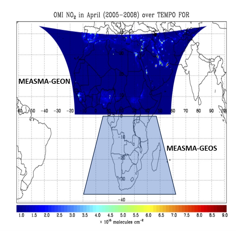
I- MEASMA-GEON (GEO-North) covers the Middle East and Africa from the Mediterranean to the Equator
II- MEASMA-GEOS (GEO-South) covers Africa from the equator all the way south to Cape Agulhas.
– MEASMA-GEO will be focus on monitoring atmospheric constituent, air quality, monitoring land and water masses over the above-mentioned field of regard in almost real time, <1h revisit time, and with high spatial resolution better than 3km.
– The MEASMA-GEO baseline will be similar to NASA’s Tropospheric Emission: Monitoring of Pollution, (TEMPO), monitors North America, and Korea Aerospace Research Institute’s (KARI) Geostationary Environmental Monitoring Spectrometer (GEMS), which monitors the Far-East. Both highly innovative instruments were developed by BAE Systems.
MEASMA-GEON and GEOS Fields of Regard
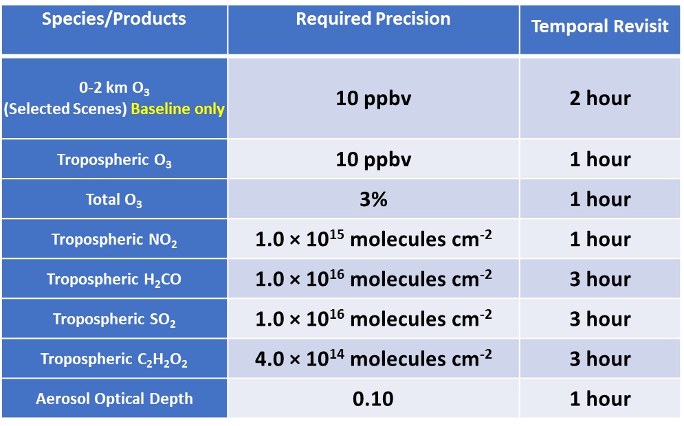
MEASMA-GEO Instruments - TEMPO Baseline and Threshold Data Products